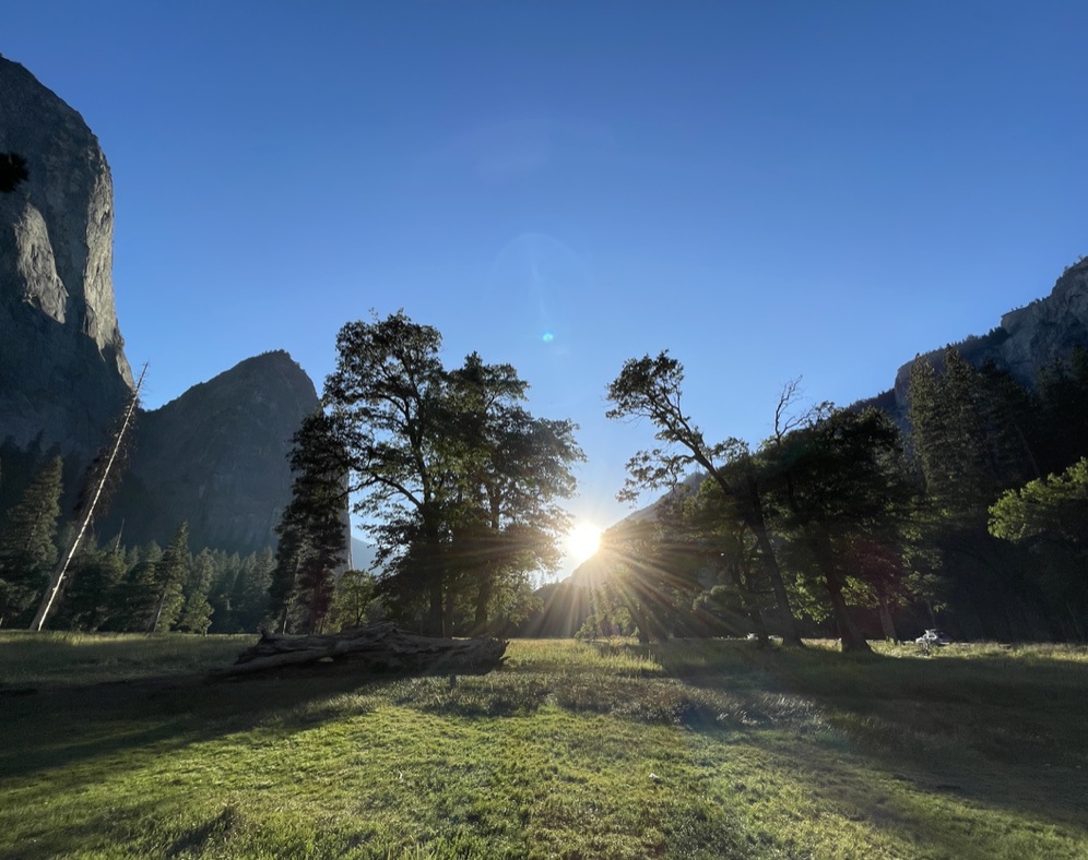
There are 63 national parks throughout the United States, and one of the very best among them is Yosemite. Officially gaining national park status in 1890, covering almost 1,200 square miles, this sprawling valley is located in the heart of the Sierra Nevada mountains, famed for it’s giant sequoia trees, numerous spectacular waterfalls, and of course the iconic El Capitan. This great monolith is revered by rock climbers the world over as the ultimate big wall to climb. It has been showcases in the the acclaimed films Free Solo and The Dawn Wall.
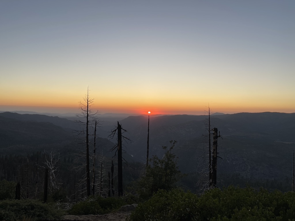
I visited Yosemite a few months ago for a few days, just a flying visit, I was pleasantly surprised to find quieter trails and cooler temperatures, turns out September is a pretty good time to go. My main reason for going was to hike up to Nevada Fall, and take in the views from the summit of the waterfall. I also wanted to hike some of trails I missed the last time. I had great time revisiting Yosemite valley.
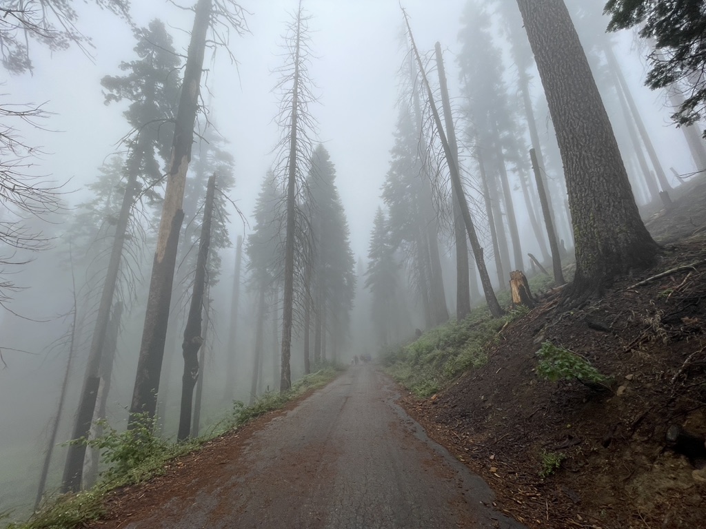
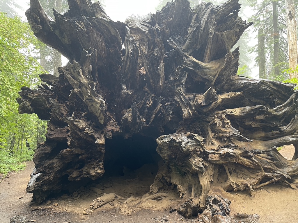
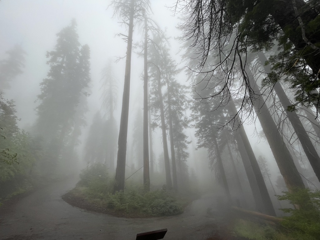
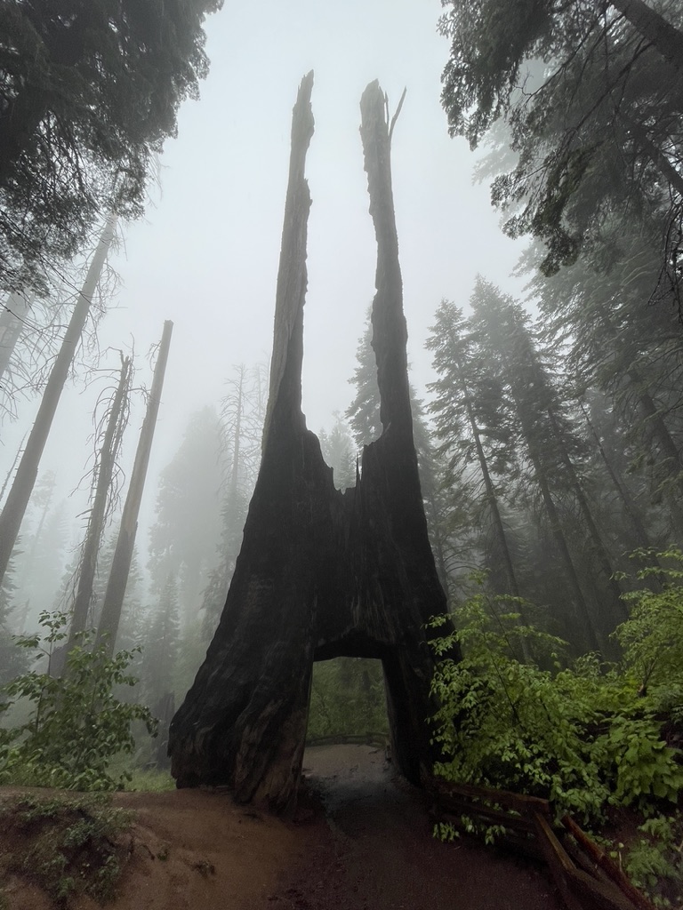
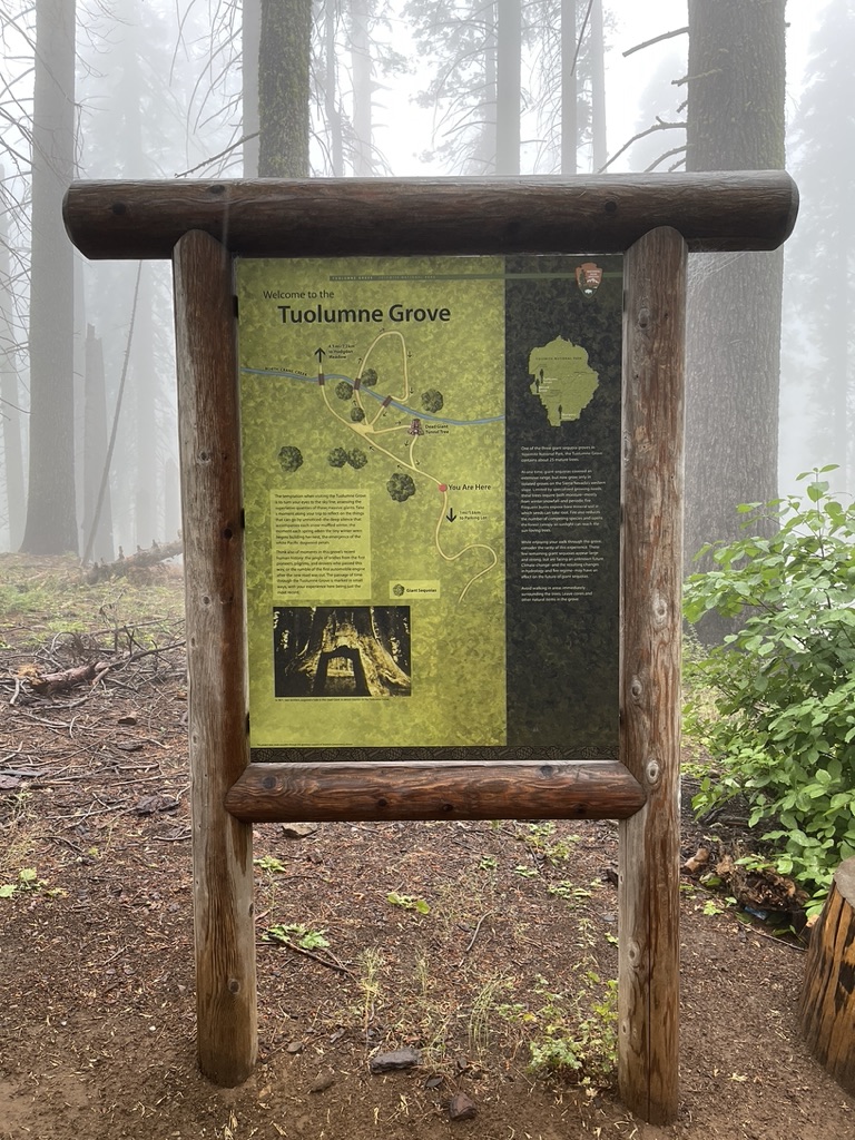
Tuolumne Grove
Distance: 2.5 miles (round trip)
Time required: 2-3 hours
Elevation: 1860m (at trailhead)
Difficulty: Easy – moderate
Trailhead: Tuolumne Grove car park
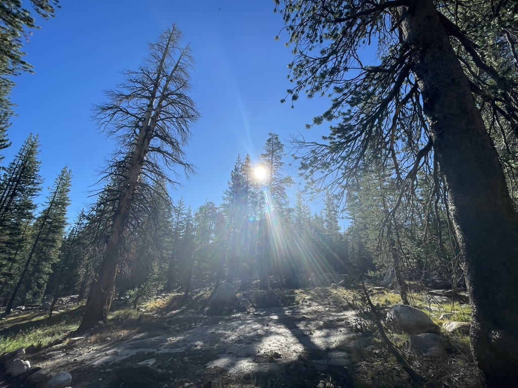
Tuolumne Grove isn’t really a hike, more of a longish walk really, but don’t let that put you off. Tuolumne Grove is still very much worth a visit. It’s not about the distance, the elevation, or the switchbacks, it’s about the tree’s, giant Sequoias in this case. This walk is a good opportunity to see the giant Sequoias Yosemite is renowned for in all their majestic grandeur. The highlights along the route are the Tree tunnel and the felled hollowed out tree you are able to crawl through. The day I visited was overcast and drizzly with a light fog hanging in the air, which paints quite a dreary picture, but it actually added to the experience of walking through the grove, giving the the trail a uniquely mysterious and eerie feeling (this would prove to be in stark contras to the rest of hikes in the coming days which would be trails bathed in sunshine). The distance for a round trip is 2.5 miles (4 km) so even with multiple stops for photos the walk doesn’t take long.
Nevada falls (John Muir up/ Mist trail down)
Distance: 8 miles
Time required: 5-6 hours
Elevation: 610m
Difficulty: Strenuous
Trailhead: Happy Isles
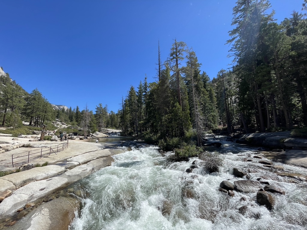
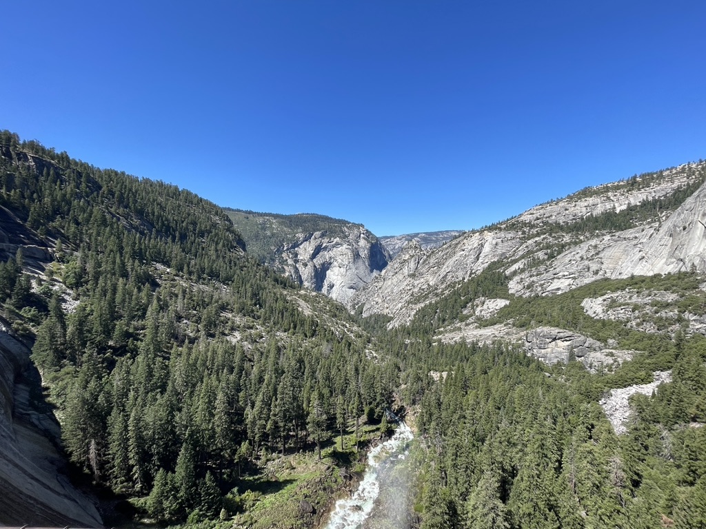
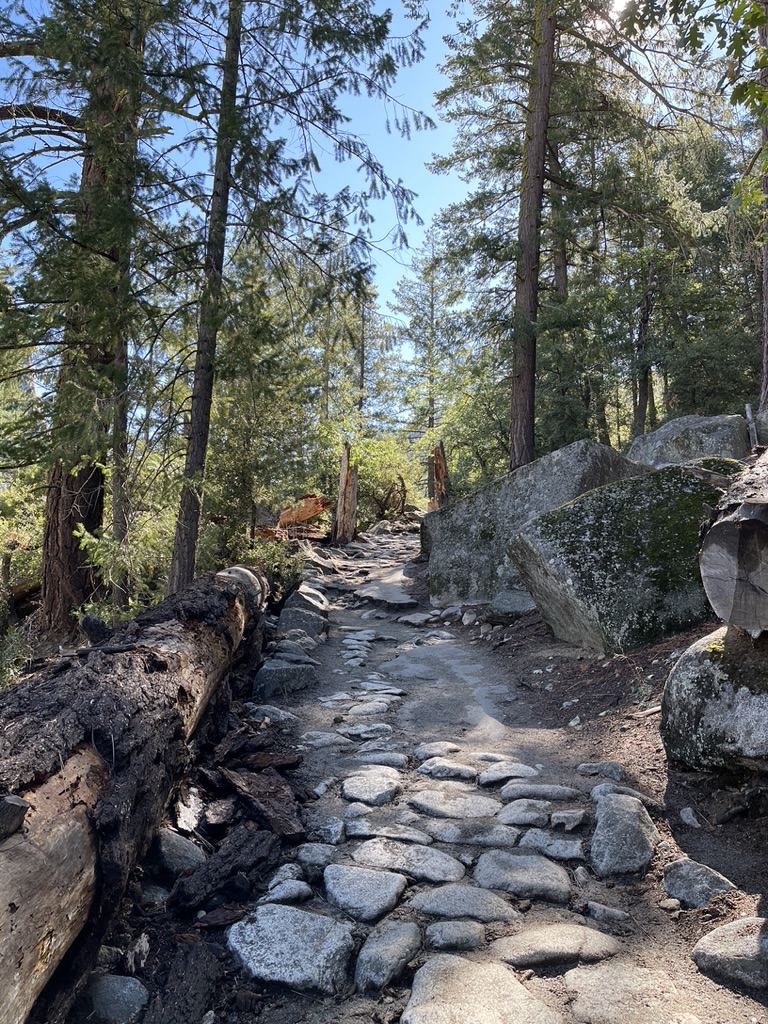
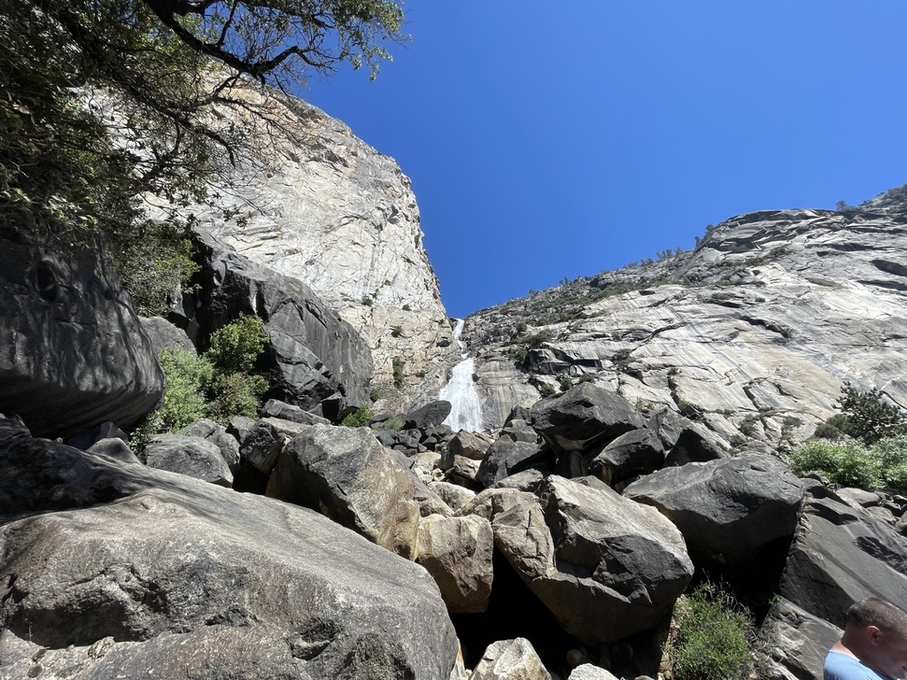
Unlike Tuolumne Grove this is most definitely a hike! It is a round trip made up of two trails, the Mist trail and the the Muir trail. The hike started off on flat smooth terrain which began to climb almost immediately with a few lazy meanders along the way. The path was partially covered by trees, creating a willowy ceiling of branches and leaves that broke up the sunlight and provided some welcome shade along the way. The paved footpath gradually faded away becoming a rocky trail, on a steady climb upwards. The official description of this hike is strenuous, which I fully agree with! About a mile into the hike I arrived at Vernal falls footbridge and got my first glimpse of Vernal Falls. The footbridge is a great spot for taking photos of the falls above, and the rushing whitewater of the Merced river below.
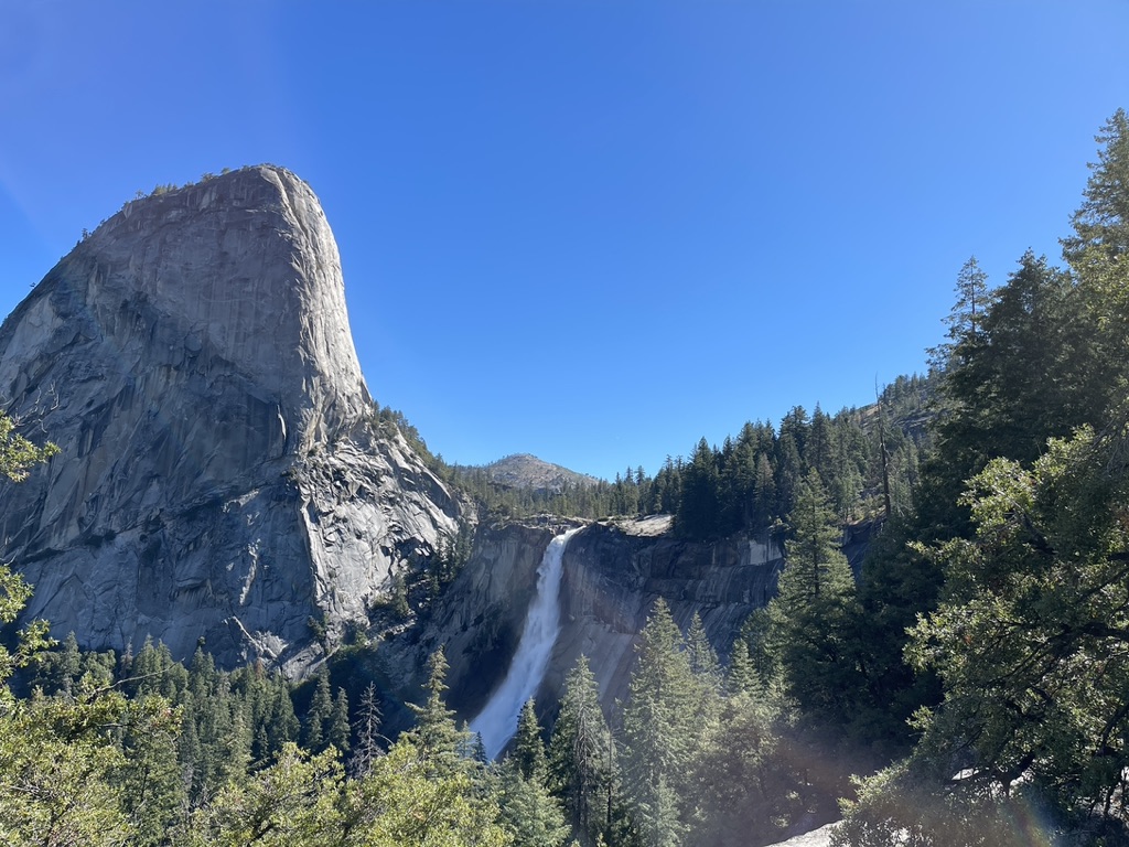
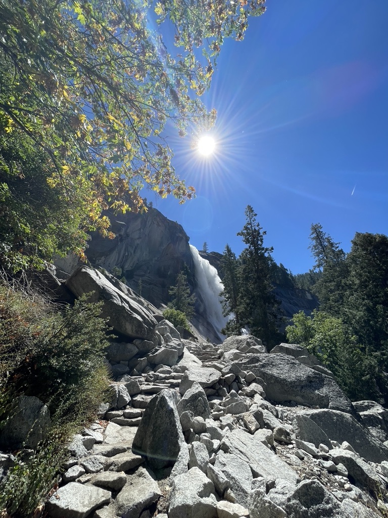
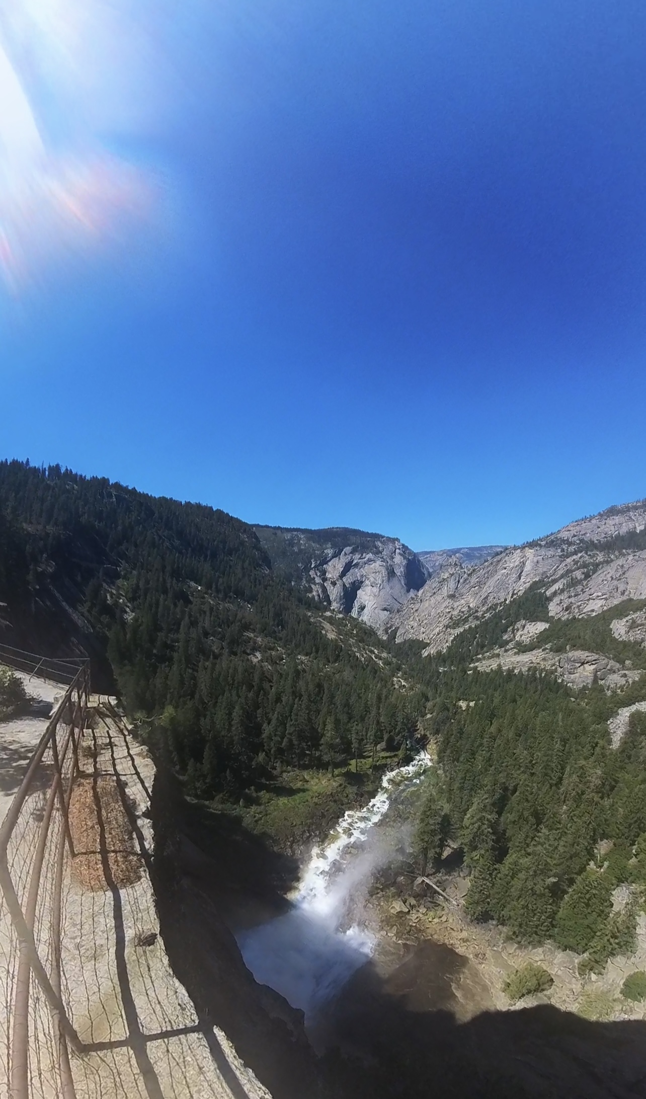
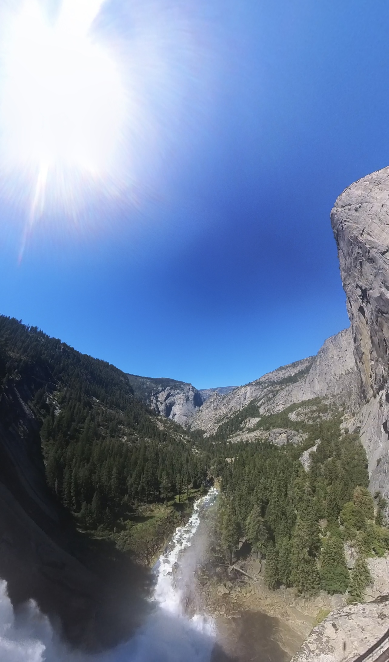
Vernal Falls footbridge is the waypoint where the trails diverge. You can stay on the Mist trail which is the more direct path and continue the climb alongside Vernal Falls, or take the John Muir trail which winds away from the waterfall into the surrounding hills. I opted for the John Muir Trail. The hike up was not easy, the path was steep and uneven with scatterings of loose rocks along the trail, oh and switchbacks, lots of switchbacks! The views along the way were good, but The Mist trail is definitely the better option for scenery and views, but this also makes it the more popular and busier route. A few toilsome but enjoyably scenic miles later, I arrived at the summit of the hike. There’s a footbridge at the top of Nevada Falls offering dramatic views of the fast flowing water disappearing over the edge of the falls. There’s also a viewpoint at the edge of the falls with great vistas of clear blue skies and the winding river in the sweeping valley below.
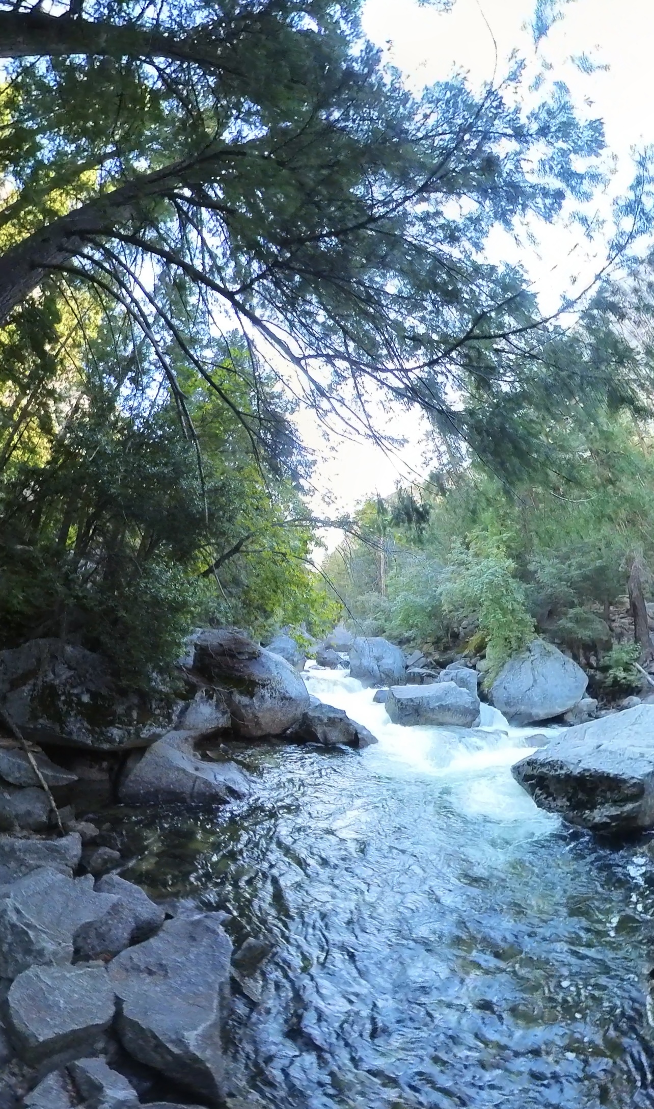
My plan was to do a round trip, so I headed back down the Mist trail. Initially the trail started off narrow and steep on uneven ground, with loose rocks everywhere, prime territory to twist an ankle. Beyond this first stage there is an opportunity to see the viewing point at the top of Vernal falls. Once I started heading down along side the waterfall the pathway became a series of large steps, and was quite narrow in parts, with little to no barriers at all. Going down the trail with tired legs was tricky, the rocks are constantly doused by spray from the falls (hence the name of the trail) making them wet, slippery and potential ankle breakers. Eventually the falls and slippery stones disappeared giving way to the usual rocky path and some narrow switchbacks. The trail eventually wound its way back down to vernal falls footbridge. From here on it was all familiar territory back down to the paved footpath for a few miles, and on to journeys end.
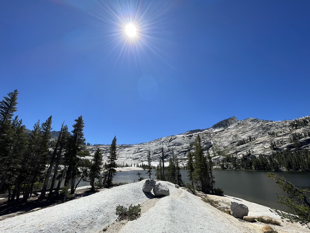
Lower Cathedral Lake
Distance: 8.2 miles
Time required: 4-5 hours
Elevation: 2830m
Difficulty: Moderate – challenging
Trailhead: Tioga road
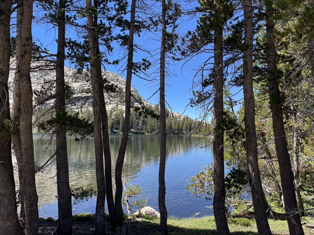
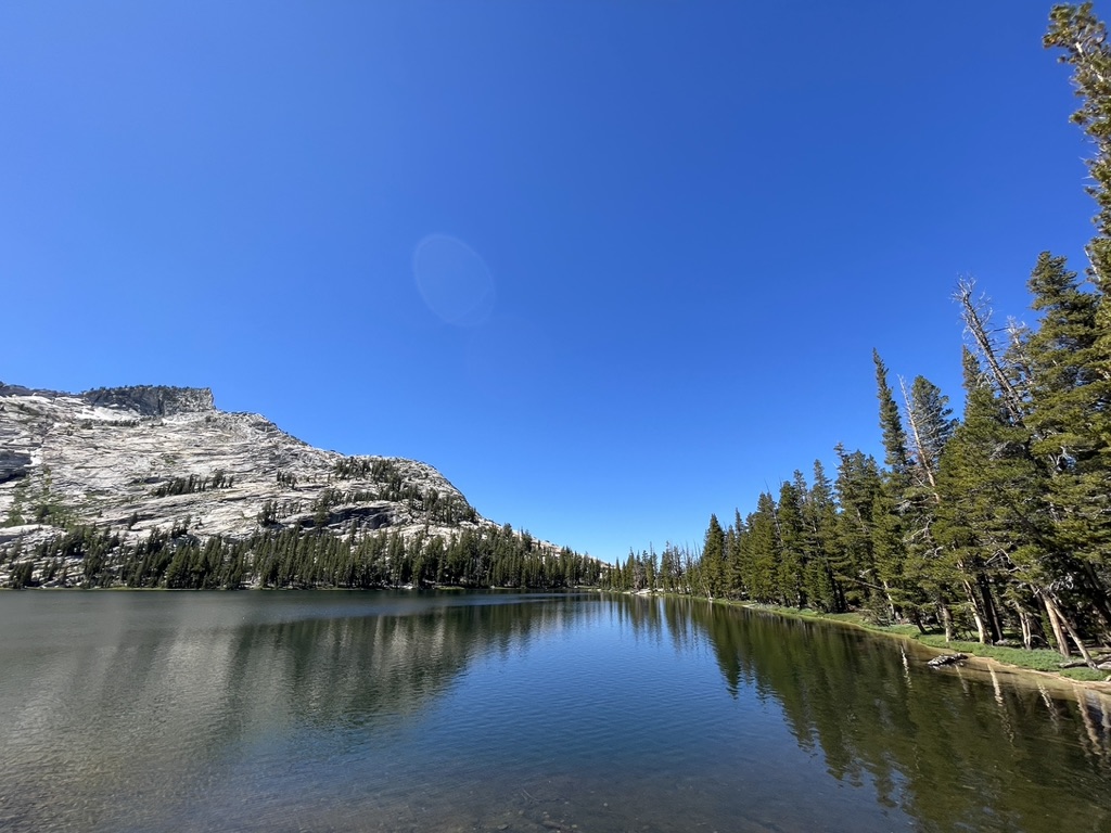
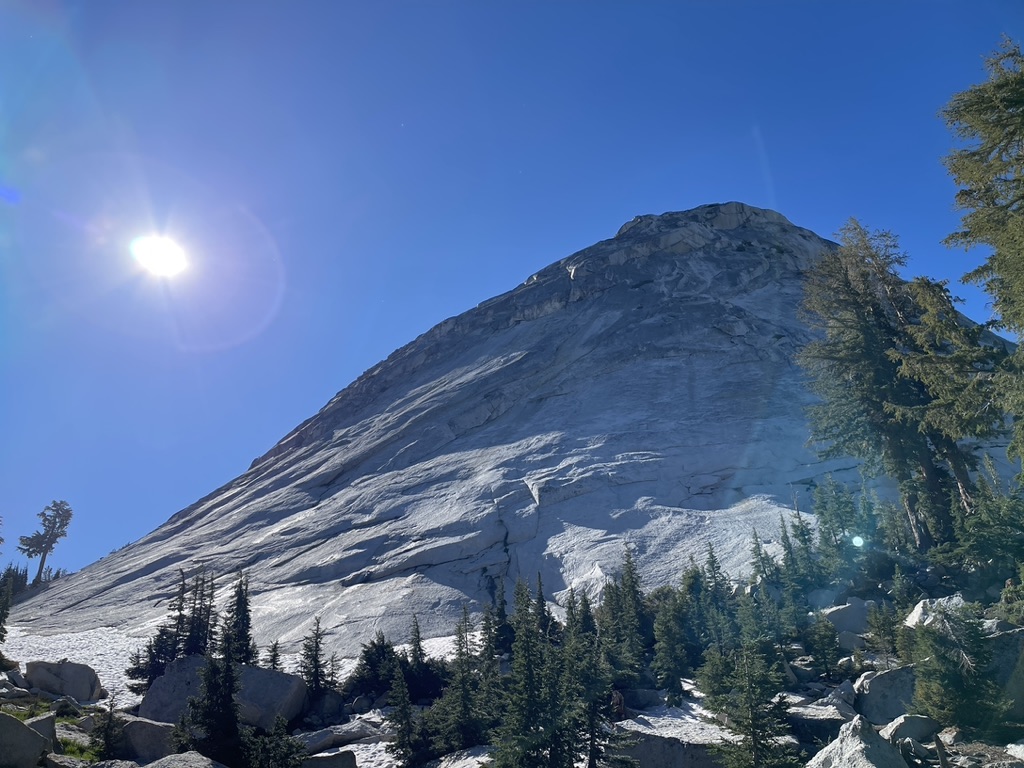
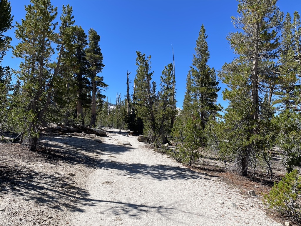
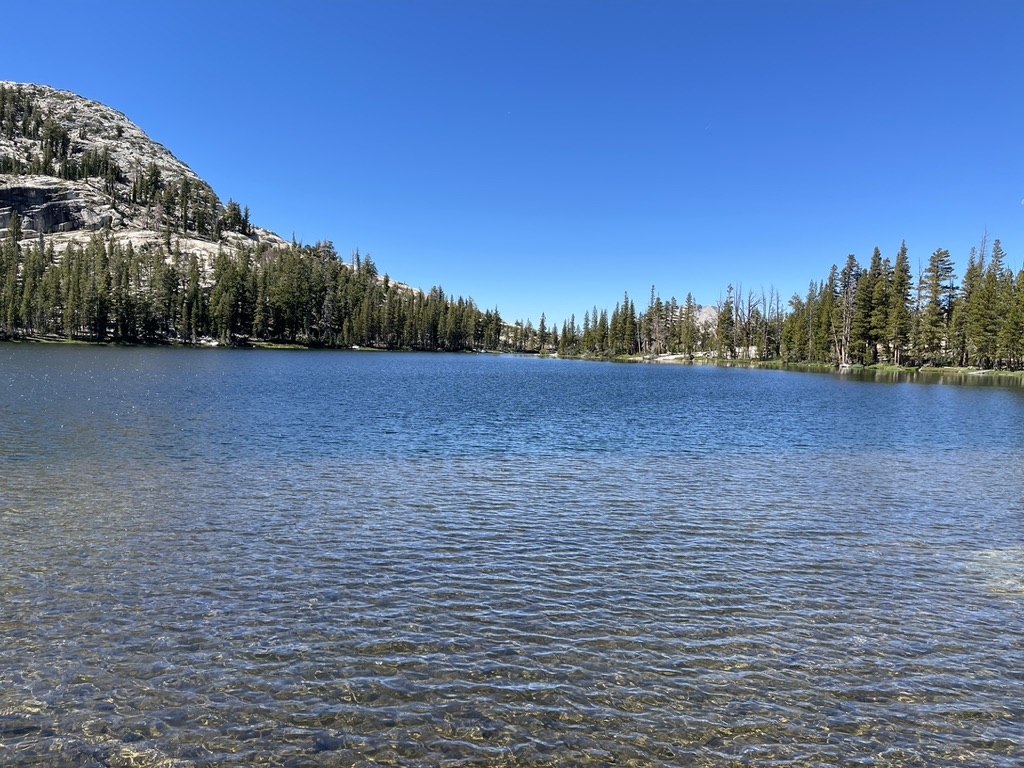
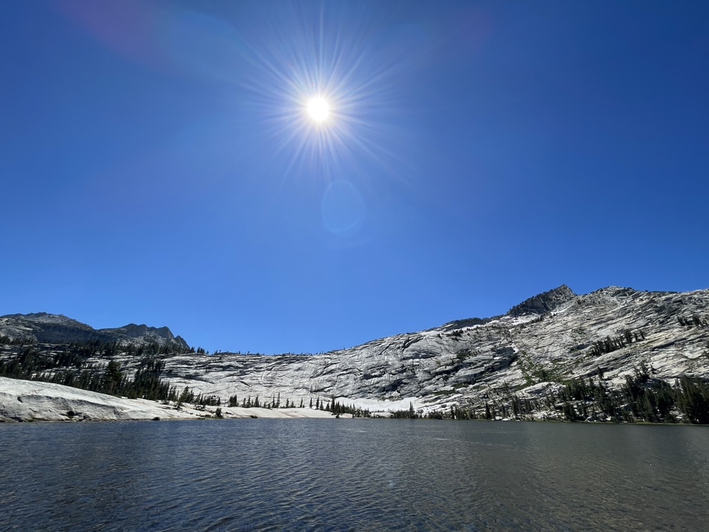
The Lower Cathedral hike is definitely worth the effort, not just for the idyllic and picturesque lake waiting at the end of the trail, but the actual hike itself, where the landscape and scenery change constantly, from forrests with small streams and fords, to rocky ascending switchbacks, through to dry and arid fields of brush. At one point hiking through a section of forrest the trees give way to a small clearing and an incredible view of a mountain with snow at its foot! Eventually the forrest relents to an open sandy dry landscape. A few fairly straight miles along this terrain then you arrive at the fork in the road, a signpost where the tail splits into the lower lake and upper lake. The lower lake is the more scenic of the two. After the signpost it’s a short easy downhill section to the lakeshore and some amazing views to take in along the way.
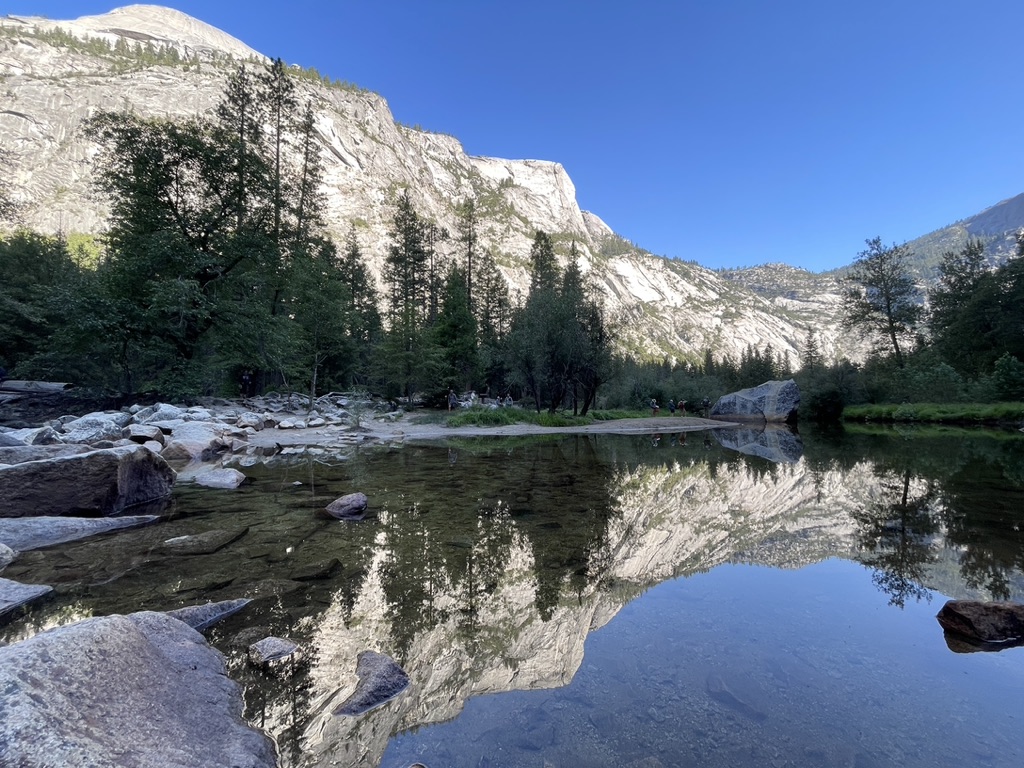
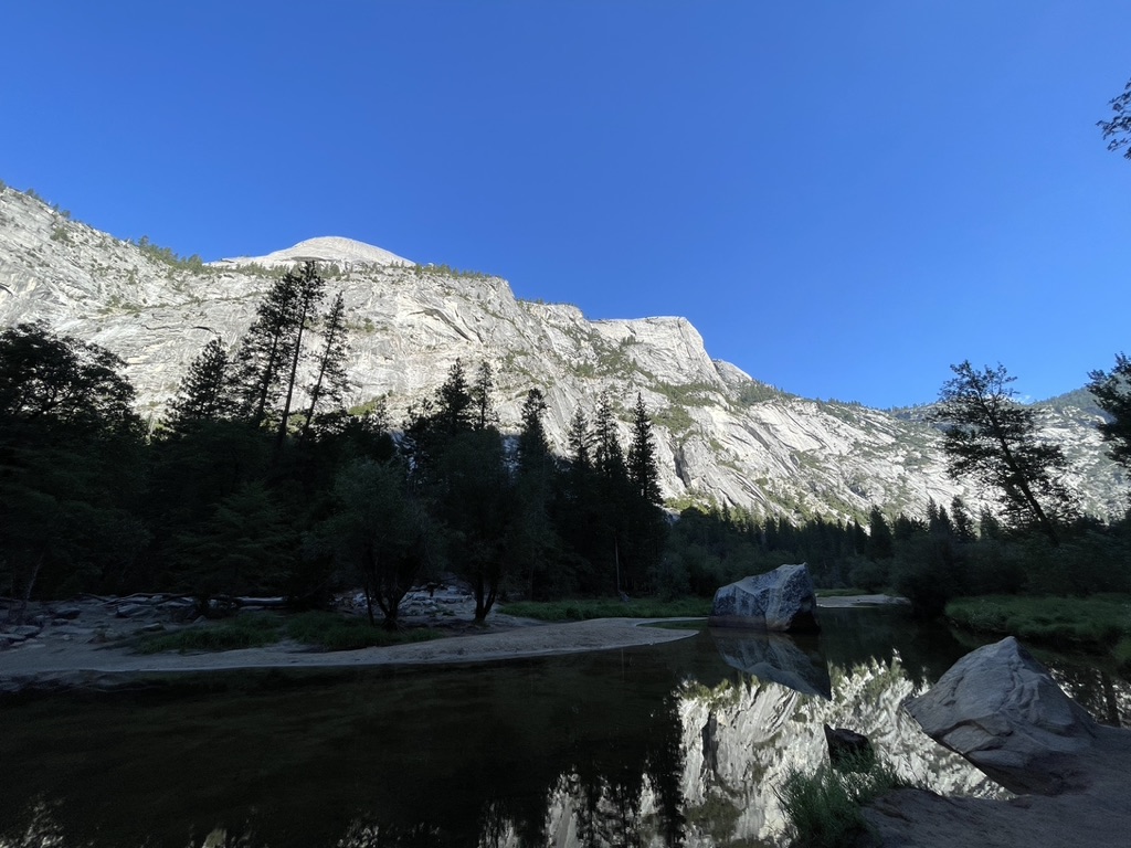
Mirror Lake and Valley
Distance: 2 miles (round trip)
Time required: 1 hours
Elevation: 33m
Difficulty: Easy
Trailhead: Mirror lake trailhead
This was a take it easy day, so no hiking on the itinerary, but I did take an easy walk up to see mirror lake. The lake is aptly named, on a clear day and standing in the right spot you can get a photo of the lake with the mountains reflected on the surface of the water like a mirror. You just need to time it right and wait for the opportune moment, when there are no other tourists in the shot. After some lunch I jumped on the bus and headed over to Yosemite valley, a great place to relax and take in the views of the great El Capitan. There was a gathering of people under the shade of a large tree who had set up telescopes to spot the climbers ascending the towering monolith, which was a pretty cool sight to see, and a good end to the day.
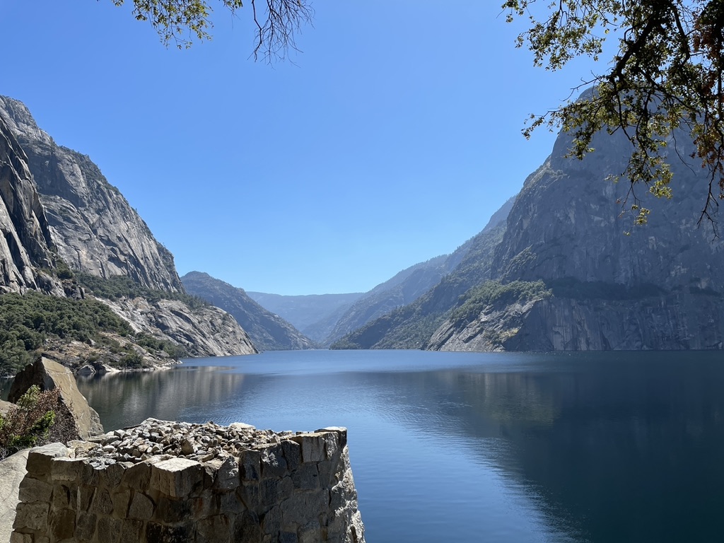
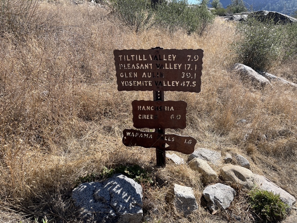
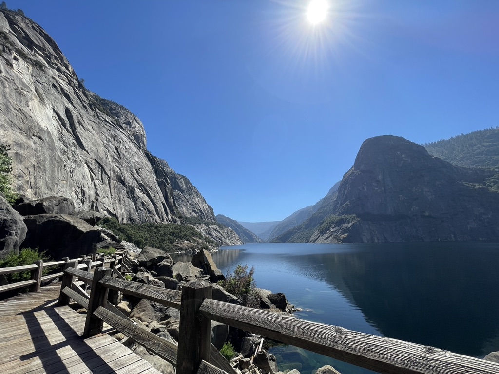
Hetch Hetchy Lake (round trip to Wapama Falls)
Distance: 5 miles
Time required: 3-4 hours
Elevation: 1100m
Difficulty: Moderate – challenging
Trailhead: Hetch Hetchy Reservoir
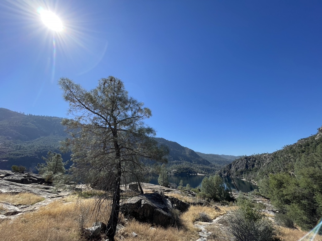
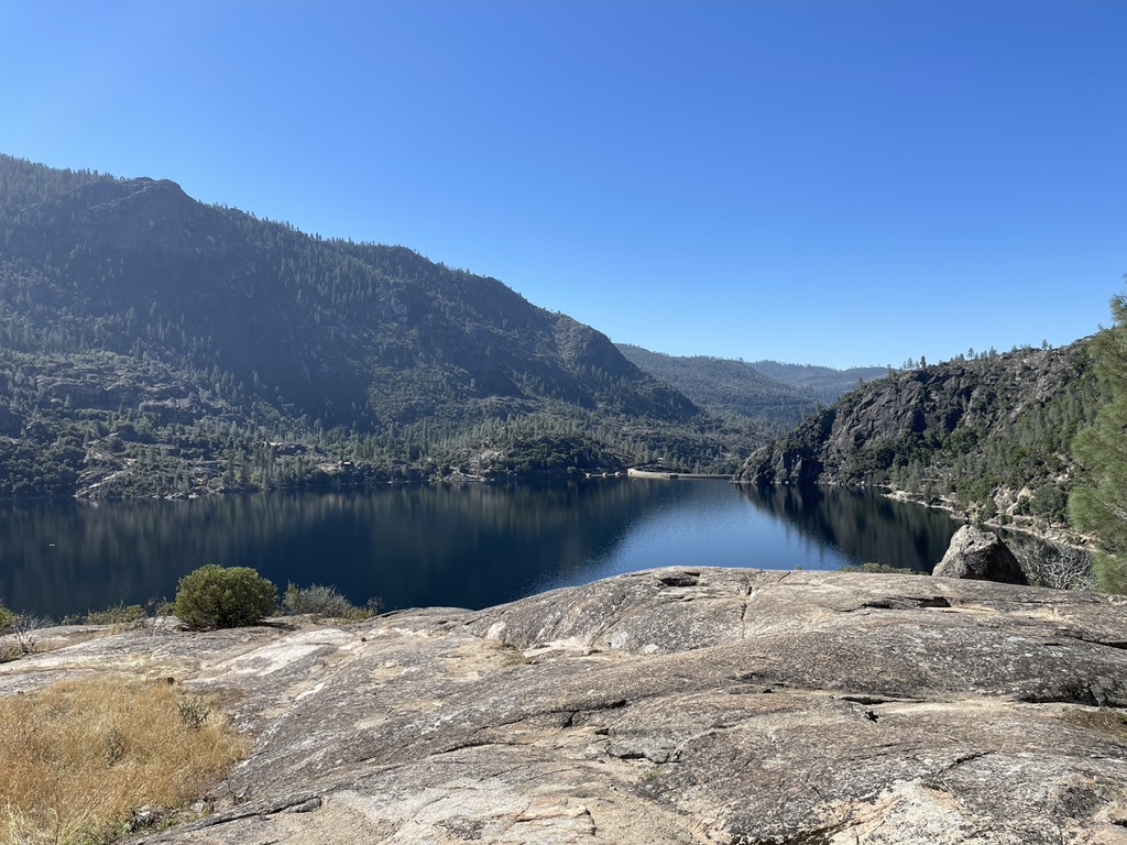
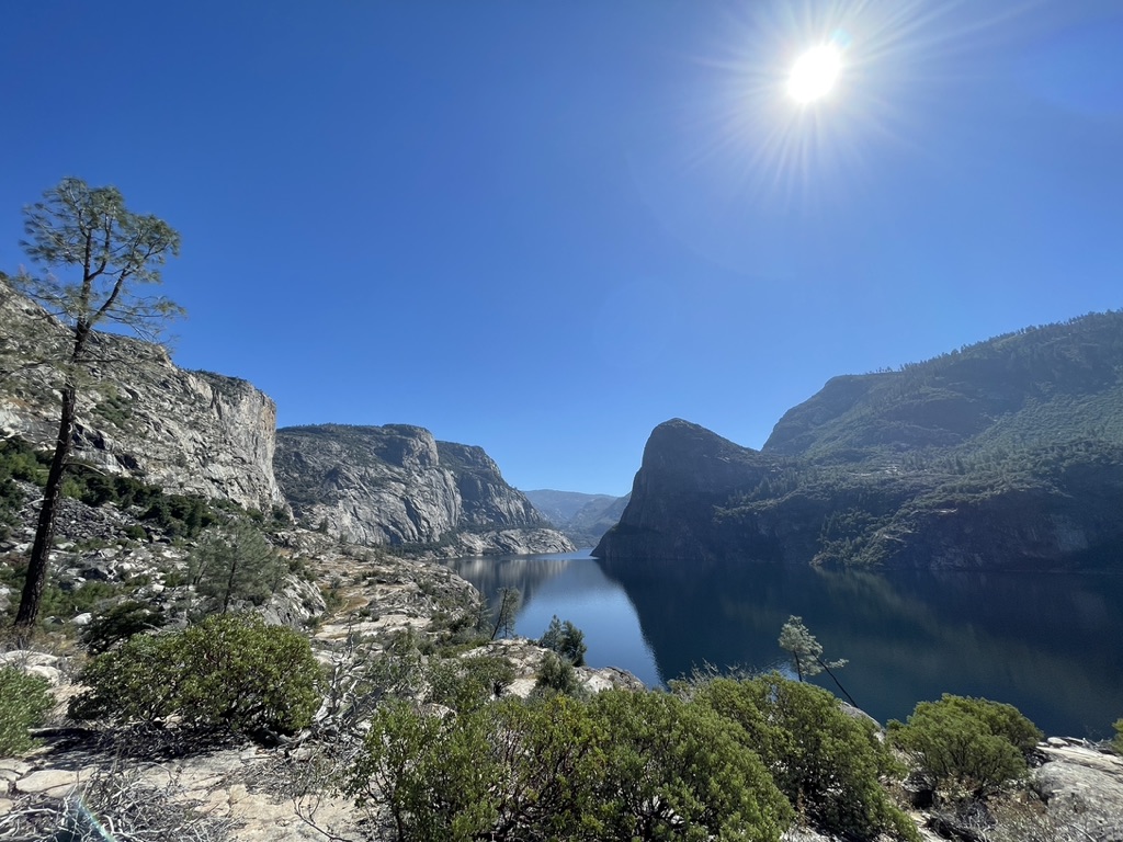
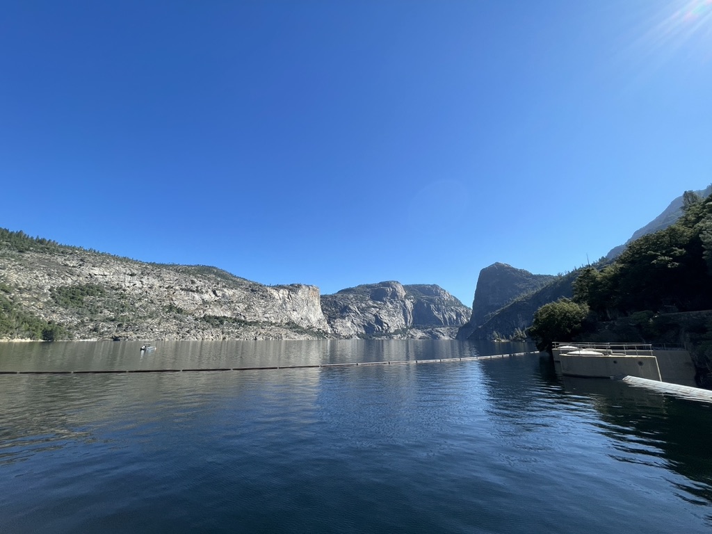
The hike begins with a walk across the impressive O’Shaughnessy Dam, (definitely worth a photo) then through a short tunnel which connects the dam to Hetch Hetchy Valley. The trail runs parallel to the picturesque Hecth Hetchy Reservoir, meandering its way along rocky terrain through thickets of bushes, dry grass and the occasional solitary tree. Initially the path is fairly even and flat, made up of a loose gravely surface but vague and almost indistinguishable at certain points. Further along, the trail becomes more obvious, made up of flat laid stones and stairways hewn from the rock. More trees begin to appear along the path,in places forming a makeshift shady shelter from the unrelenting sun. There are two waterfalls along the trail, the first is Tueeulala falls which had run dry, a few dark patches on the rock wall were all that served as evidence of its former flowing glory. Wapama Falls is the second, and the waypoint for my hike. A short stone stairway precedes the footbridge across Wapama Falls which winds around the side of the waterfall, making for a majestic view. Wapama Falls was flowing, but only just. The real star of the show was the reservoir. The grand sprawling lake almost perfectly framed between the valley walls stretching away into the far off distance is an incredible sight, and endlessly photogenic, it’s almost impossible to take a bad picture.
Hetch Hetchy was the last hike and the end of my trip in Yosemite. I had a great time on the trails and being back in the park again. I enjoyed all the hikes, but if I had to choose just one, it would have to be Nevada Falls. For me it’s still the best. Amazing views and two awesome falls! Hiking doesn’t get much better than that.